
The Faroe Islands are remote and hard to reach—and that’s a good thing. It means you should go now, before the crowds inevitably descend and the islands become the next Iceland, which has become rather too popular for its own good. Where are the Faroes, you ask? And why go there? Both good questions…
The Faroes are an isolated set of islands located roughly halfway between Scotland and Iceland. The inhabitants, numbering just 50,000, are descendants of the Vikings, and their language, Faroese, is most closely related to Old Norse. Volcanic, this set of 18 islands is well connected through a network of tunnels and helicopter routes (in fact, it’s currently home to perhaps the cheapest helicopter rides you can take, at roughly $20).

View from the lighthouse on Mykines
Upon landing at Vágar airport, you may want to head directly to Mykines, an island that is accessible only by ferry or helicopter. Known for its large population of local birds, including puffins, gannets, and fulmars, among others, it has no real roads or cars, giving it that sleepy end-of-the-world feeling. One of the locals, Heini, whose family has been on the island for generations, runs a fantastic day hike to the picturesque lighthouse at the eastern end of the island (he also rents out his cottage). At one point during our walk, Heini asks our group of 10 or so from around the world to be silent. As our ears open up to the sounds around us, we begin hearing individual bird calls in addition to the crashing waves in which the birds fish. We hear no man-made noise: no airplanes, no distant highways, no sirens. For a New Yorker, this is the ultimate escape.
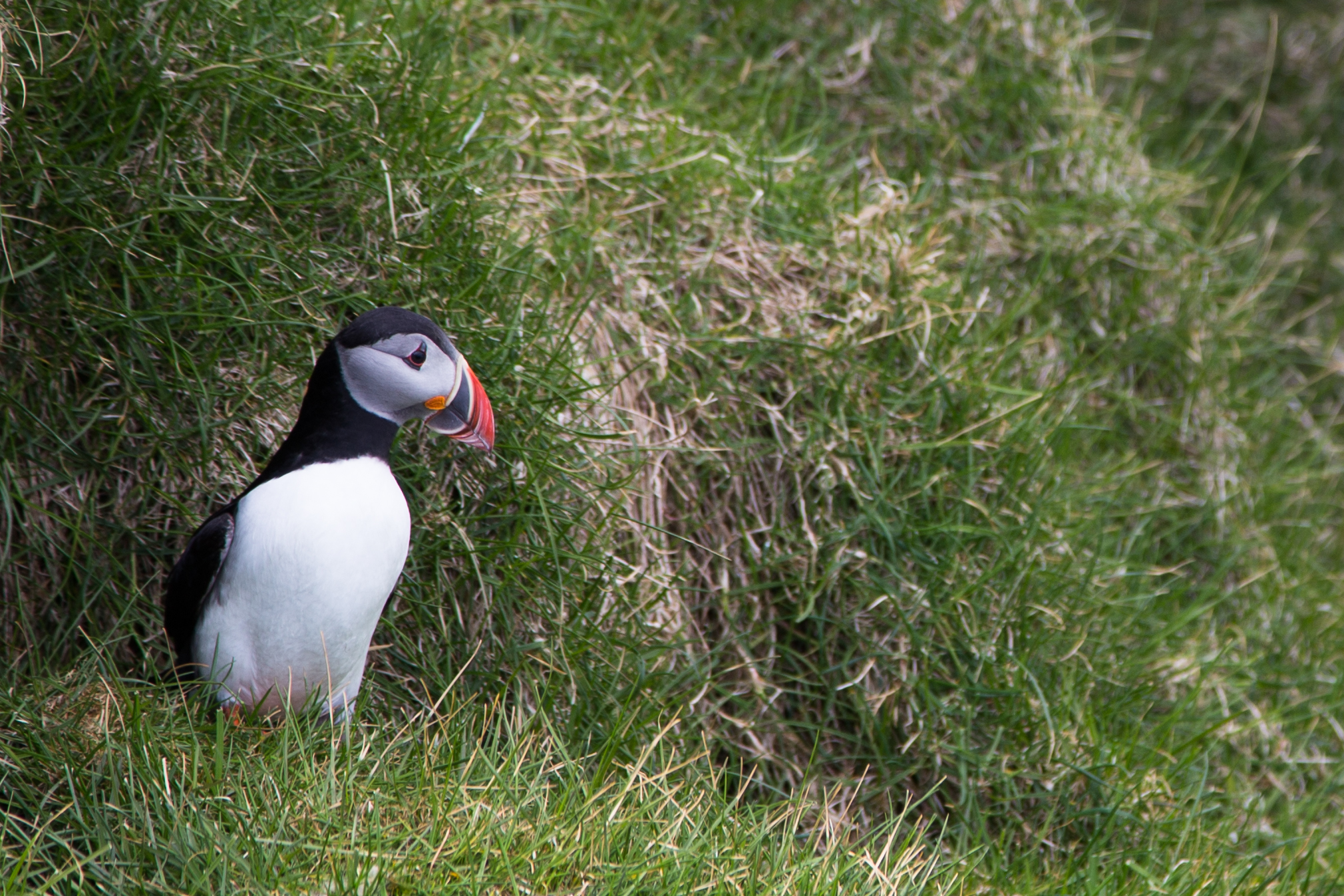
Puffin on Mykines

Gannets off Mykines
The helicopter flight back to Vágar airport is about as glorious as 10 minutes can be: dramatically jagged cliffs and small beaches set against vibrant blue skies. With the flights subsidized by the Faroese government at roughly $20 a ride so that locals can get around with greater ease, it is perhaps only a matter of time before tourists are restricted or asked to pay unsubsidized fares.
To explore many of the remaining islands, a car can come in handy. Avis and Hertz operate on the islands, as do a few of the local companies, like 62 North. Given the last-minute nature of my trip, the best deal I found worked out to roughly $100/day—not cheap, but after all, you are on some of the most isolated islands on the planet.

Gasadalur and Múlafossur waterfall
A first stop might take you to the village of Gasadalur, via one of the islands’ one-way, rock hewn tunnels (be sure you heed traffic signs), to experience the picturesque Múlafossur waterfall dropping into the ocean below. You may want to follow that with a brisk 45 minute level hike to Trælanípan via the western side of Sørvágsvatn, the largest lake in the Faroes. From here you’ll experience a curious optical illusion: the lake appears to be a couple hundred metres above sea level, when in reality, it is only about 30. This was the only paid hike I experienced in the Faroes, at a cost of 100 DKK, which was easily payable by credit card with the friendly local at the entrance from the car park.

Trælanípan
Another hike that is one of the highlights of the Faroes is up to the Kallur lighthouse on Kalsoy. Kalsoy, comprised of a long, thin stretch of mountains diving into the sea, is reachable by ferry from Klaksvík, the Faroes’ second-largest town (be sure to arrive at least 30 minutes in advance to be assured a spot on the ferry). The hike begins from Trøllanes and takes roughly 75-90 minutes. Worthy of a stop en route is Mikladalur, where a statue of the seal woman Kópakonan from local legend gazes over the town.

Klaksvík

Kallur lighthouse, Kalsoy

Near Kallur lighthouse, Kalsoy

Kópakonan (Seal woman)
And who could resist visiting the highest peak of the Faroes, Slættaratindur? You’ll see a small parking lot just off the main road between Eiði and Gjogv. From here, the peak is about a 60-75 minute pure uphill hike. As you near the top, the hike becomes more of a four-legged scramble, and you may encounter snow. But the view is worth it: on a clear day, you can see most of the 18 islands that comprise the Faroes. Also not to be missed, a short drive away, is an easy, 10 minute walk from the main road to Hvíthamar, with a view of Funningur and the surrounding fjord.

View from the top of the world, Slættaratindur

Gjogv
Of course, driving through each village in the Faroes is like scrolling through the list of available dogs for adoption at your local shelter: each one induces successive exclamations of “Ooh, how cute!” One of the best known is Saksun, with picturesque grass-covered structures and the requisite steepled church encompassed by waterfalls gushing from the surrounding hills. The drive there alone is stunning, even without a place like Saksun at which to linger at the end.

Saksun

Near Tjørnuvík
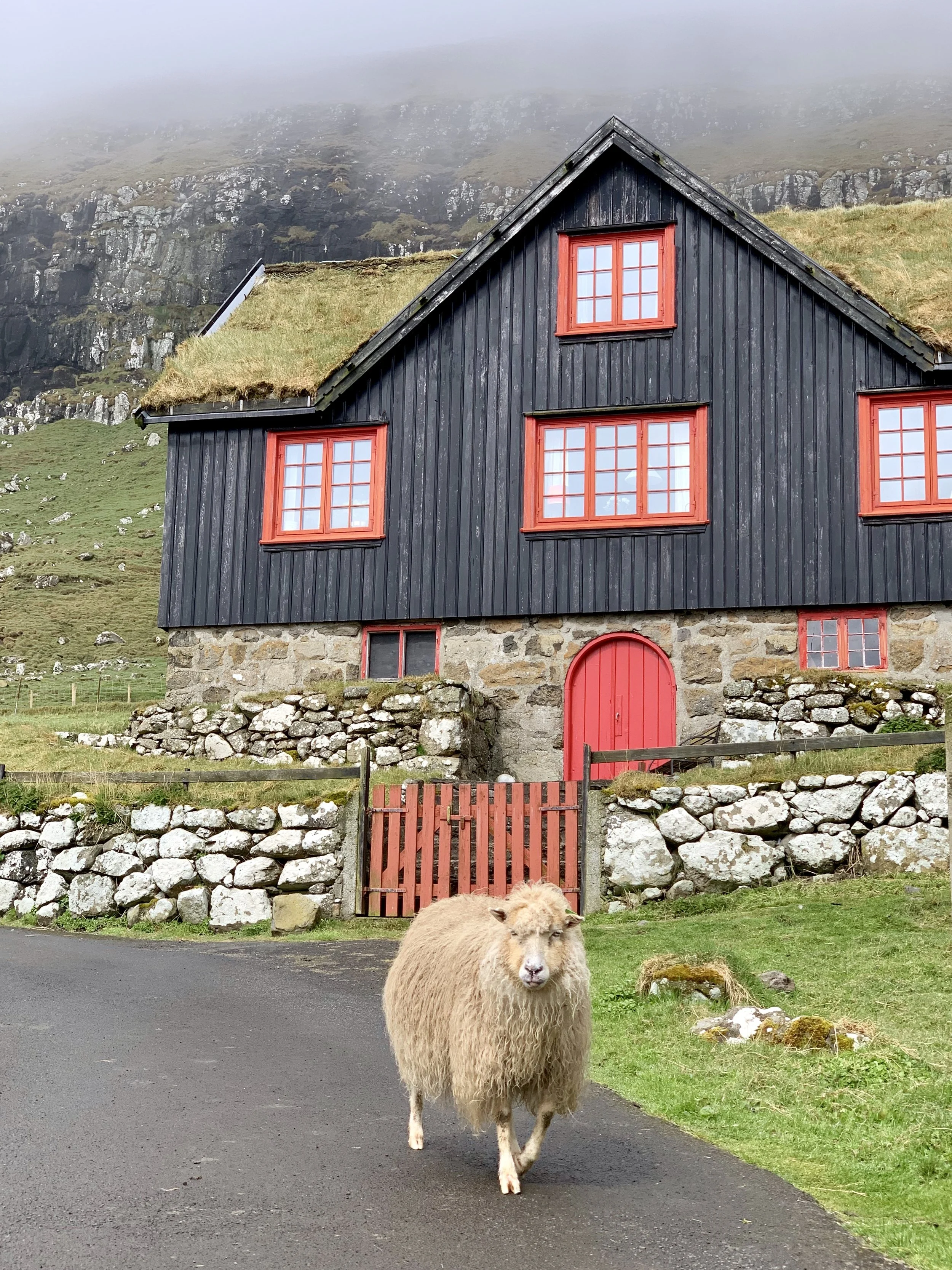
But a large part of the appeal of the Faroes is to lose—or perhaps find—yourself in its isolation. For me, that place was Tjørnuvík and its surrounds. At the end of the road, featuring Viking graves with a large expanse of beach overlooking two rocky pillars (named Risin and Kellingin, or the Giant and the Witch, after a legend in which the two tried to steal the Faroes to bring them to Iceland), Tjørnuvík is as sleepy as it gets. At night, in the hot tub of my Airbnb, I listened to the waterfalls running down the surrounding mountains under the light of the full moon. In the morning, I ate waffles with rhubarb jam while watching the resident geese and sheep saunter between the two dozen or so houses that comprise the town. I felt at peace.

Heimablídni at Maud Hansen’s house on Nólsoy
On one of my last evenings, I had the privilege of experiencing heimablídni, or home hospitality, at the home of Maud Hansen on the island of Nólsoy (easily reachable by ferry from Tórshavn, the capital). Maud is a gifted chef, and she prepared a typical Faroese meal focused on seafood, including local staples like fermented lamb. It was one of the highlights of my trip, and while I was lucky enough to go on a day’s notice, it is generally advisable to book in advance.

Tórshavn
Kirkjubøur
I also paid a visit to the capital, Tórshavn (or “houn”, as a the locals call it), which comprises 20,000 of the island’s population of 50,000, and feels like a cross between a colourful fishing village and a local commercial centre. You can eat very well at Barbara Fishouse, or Ræst, known as the only restaurant focused on fermented food outside of Japan, followed by a cool beer at Mikkeller, which has an outpost there. A short drive away is the historic village of Kirkjubøur, featuring the oldest church of the Faroes, built before 1200. I felt so safe that I gave a ride back to a few other tourists who had hiked there from Tórshavn before returning up north to my Tjørnuvík Airbnb. I had started to settle into the calmer local rhythms, and I was enjoying it. If you are looking for a place to reflect, and to spend time in true nature, the Faroes should be your next destination.

Tjørnuvík

Midnight sunset, Tjørnuvík
Packing list
Hiking gear
Many layers (the weather can change very quickly, and it can be quite cold, even in summer)
Sunscreen
Where to stay
Where to eat & drink